Astute readers have been hearing me talk about the southern Santa Cruz Mountains for years.  A search of this very site proves that I may have a thing for those roads and goat trails and ghost towns.   However, did you know that there are also northern Santa Cruz Mountains? Well, OK, you probably did.  But I don’t talk about them that much, which is a darn shame, because those roads, predictably, also rule.
I did a short ride there last weekend, starting in — shock — Half Moon Bay. Fall is the best time of year for the coast, in my opinion, as long as you don’t go on the weekend of the annual Pumpkin Festival. Â Do that and you’ll be sitting in traffic for the rest of your life. Â But otherwise, the weather is fantastic, the pumpkin stands are bustling, and the roads are inexplicably empty.
Pumpkin patch entering Half Moon Bay:

The Lemos Farm horse says “Happy Halloween!”

One entertaining thing about the coast is that the weather can change in, oh, about an eighth of a mile. Â Those pictures above look bright and sunny, no?
Less than a mile later:

Ah, the coast.
Fortunately I was turning inland again once I’d wandered south a little bit; the fog was sticking pretty solidly to the coastline.
Less than a mile inland, on Lobitos Creek Cutoff, the fog was already lifting:

Lobitos itself is a small community that’s pretty much scattered ranches and farms. Â Highway 1 used to pass along this route but it was eventually moved west along the coast, closer to the Ocean Shore Railroad line. Â The line ran from Tunitas Creek to San Francisco and was primarily used in the beginnings of the 20th century. Â Service was largely abandoned in 1921, though some portions of the railroad were taken over by Western Pacific and ran into the 1980s.
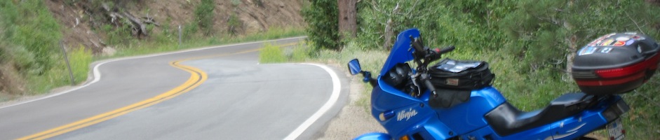
Lobitos Creek Cutoff does not suck. Â This is pretty much motorcycling nirvana. Â People who wonder why I “only” have a 250cc bike should look at these photosany time they want to disparage the Ninjette. Â These roads are WAY more fun on a small bike than a supersport, I promise you.


I never get sick of the self-portraits.

And into the trees, which are incredibly frustrating to photograph. Â *shakes fist at lack of light amongst redwoods*

The other side of the trees:

Lobitos Creek is full of horse ranches, but don’t take my word for it:

I was puttering along Lobitos Creek at the summit when I came across these horses. Â I had to stop and play paparazzi for a while; the effect of the white horse with the fog and the hills was too good to pass up. Â It made me wish I was a better photographer, because the pictures just don’t do the scene justice. Â It was utterly silent and bright and beautiful.


After the horse ranches on the summit are a ton of fun switchbacks as Lobitos Creek descends the hill.


The ubiquitous random eucalyptus grove:

Lobitos Creek ends up back on Highway 1 (you can tell the above photo is getting back into the fog along the coastline). Â I wasn’t quite ready to head home, though, so I turned back inland onto one of my favorite backroads in the area, Purisima Creek Road.
Once again, the first part of the road was fogged in along the coast but it dissipated quickly and dramatically, allowing for some great photos. Â The bike was almost completely in the sunlight despite the encroaching fog.
The fog comes in on little Ninja feet:


I was toddling along at about 25 mph with my visor mostly open, enjoying the fresh air. Â About five seconds after I took the following picture, a bug hit me square in the right eye, forcing me to pull over and wait a few minutes until I could see again. Â Doh.

Purisima Creek Road becomes Higgins Canyon Road, which has some of the most beautiful views of the canyon (presumably, Higgins Canyon) I’ve seen. Â It does not, however, have shoulders. Â So no beautiful vista photos for you. Â Sorry.
As a matter of idle curiosity, the internet tells me that Higgins Canyon is also a steep, ice-filled canyon in the Horlick Mountains in Antarctica. Â My direction sense is, granted, terrible, but I’m pretty sure that’s a different one.
No ice here:

Higgins Canyon winds up back at Highway 1, conveniently right across the street from Cameron’s. Â Why, certainly, if you insist!
The Tiger Lily junk got into the Halloween spirit:


It was in the 50s and I’d been riding through fog, so what better beverage than a root beer float? Â Peter, who has famously chosen root beer floats while visiting the Arctic Ocean, should be proud of me.

OK, so he has more root beer float street cred. Â I’m working my way up to his level.

That’s the second polar reference (with ice, even) in this blog entry. Â I must be gearing up for the upcoming winter. Â I’ll have to find a way to work glaciers into the next entry. Â Or penguins.
OK, back on topic.

I headed north for a little bit along Highway 1, because it looked like the fog was burning off. Â Unfortunately, the cake was a lie, and it quickly fogged back in and left me cold and grumbling on my way up to Pacifica.
I turned inland at Pacifica and hopped on the interstate for the dozen or so miles back home. Â Naturally, this part was sunny. 😉

I should now be only one blog entry behind, but I actually went riding again this afternoon, so I’m still stuck on two entries behind. Â Curses!
One Response to Northern Santa Cruz Mountains