There was slow improvement this morning as I woke up 45 minutes past my usual wake up time. Â If I stay on vacation for another few weeks, I may actually catch up on sleep.
I had Ride Malaise today. Â No routes were really jumping out at me as “must do”s and so I put together a big loop just sort of as something to do. Â My plan was to head to Truckee, then loop around to Downieville, Nevada City, back to Truckee, and ride the west side of Lake Tahoe back to the hotel. I wasn’t really feeling it, but I couldn’t think of anything better. Â Fortunately, fate stepped in and planned a much better ride for me.
I was less than a block from my hotel room when I realized the GPS had turned off. Â Hitting the power button did nothing. Â I pulled over into a strip mall lot to investigate. Â 10 minutes of doing everything I could yielded no results at all: I pulled the batteries and re-inserted, I pulled the rubber weather protection off the recessed power button and tried manually hitting it with my Leatherman screwdriver, I tried hard rebooting the device. Â Nothing. Â I decided the only course of action was to buy a new GPS.
Let me back up for a second and explain this decision. Â Some people have a poor sense of direction. Â This is a laughable understatement to describe the Teflon repellant my brain has when it comes to navigation. Â When I’m lost, I almost literally cannot function. Â It is insanely stressful and absolutely Not A Pretty Sight. Â So, a new GPS it would have to be. Â OK, no problem, I’m in South Lake Tahoe — the adventure capital of the Sierras! Â People come here from all over the world to hike, backpack, ski, etc in the backcountry. Â There will be a place to buy a GPS.
Wrong. Â There is not. Â I called a half dozen sporting goods stores and stopped into two of them and they all looked at me like I was insane. Â The sales guy at Big 5 tried to sell me a SPOT instead. Â I told him I already had one. Â “They’re just like a GPS!,” he said. Â “No, they’re not, really.” I said. Â “With a SPOT, they can find your body!” Â Well, OK, that is demonstrably true, but the problem was that *I* wanted to find my body first.
Radio Shack did have GPS units, but they were all Garmin Nuvis (automotive units). Â I bought one anyway but had to return it after just a few blocks when I realized it was impossible to read from within the map pouch (to its credit, though, it was usable both through the map pouch and with gloves on, so if I’d had a way to mount it to the handlebars, it would have been OK).
I decided, well, fine, I’ll buy a map. Â Gas stations have maps! Â I stopped at the first gas station. Â They did not sell maps.
At this point, I decided to give up on having any fun whatsoever and I returned to the hotel room. Â For no reason whatsoever, as a last-ditch effort, I took out the GPS batteries one more time and put the batteries from the SPOT in. Â Wouldn’t you know it, the fucker started right up. Â And the GPS batteries worked just fine in the SPOT. Â I have no idea. Â It was so ridiculous that I wasn’t even upset.
OK, but now I’ve wasted two hours of my day and I haven’t gone anywhere. Â Clearly my big loop wasn’t going to happen. Â I decided instead to just head to Markleeville for lunch — I like Markleeville and I vaguely remembered enjoying the roads around there. Â I was less than 5 miles from the hotel when I realized that this was a great idea. Â Instead of fretting about the big loop, I was relaxed and happy.


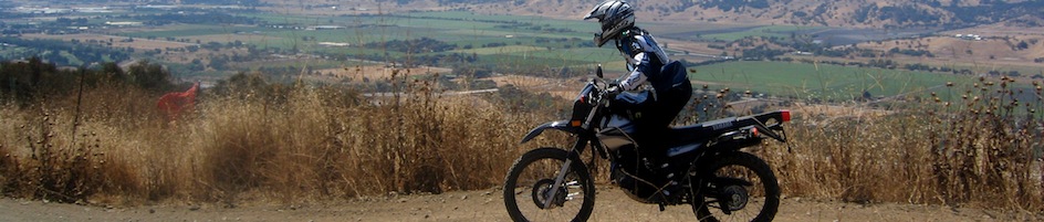
Markleeville is only a 30-mile ride from South Lake Tahoe, so I arrived quickly. Â There were a group of motorcycles lining the main drag; there isn’t much in any direction for miles and miles, so everyone had the same idea for a lunch spot! Â It looked like everyone had gone into one particular restaurant, so I chose a different one that I’d never tried before (Wolf Creek Restaurant and Bar in the old Alpine Hotel). Â It was really good and I’ll definitely eat there again. Â I struck up a nice conversation with the guy at the table next to me, who is a nurse in Carson City and is just starting a week-long vacation to camp by himself and recharge.
While gearing up to leave, I chatted briefly with a couple who pulled up on a F650GS Dakar. Â We nerded about the Beemer thumpers for a few minutes and the wife and I talked about cross-country riding while her husband went into the general store. Â They were super friendly and looked like they were having a great ride.

From Markleeville, I decided to head to Topaz Lake, NV. Â My logic was simple: Â I figured there would be a “Welcome to Nevada” road sign there. Â I was still annoyed that the Nevada state sign in South Lake Tahoe is inaccessible and I wanted to show off that I’d finally left the state again! Â So, even if I was only going a few feet into Nevada today, by God, I was going to get a picture of it.
Now, the plus side to this plan was that I got to cross Monitor Pass. Â All of the Sierra passes are spectacular, but Monitor fascinates me. Â You’ll see why.
First stop: East Fork Carson River. Â This is the very southwestern edge of the Carson River Basin, which stretches northeast all the way into northern Nevada.


As the road climbs up and up, the alpine timber gives way to high desert. Â This is one of the reasons I love Monitor Pass so much — so many distinct ecosystems just along one stretch of relatively short road.

The summit is just over this crest:


Definitely a desert vibe going on past the summit.

Coming around a corner suddenly opens up this massive view of the valley below. Â I got better pictures on the way back, but to whet your appetites:

I also fell in love with the thistle that you can see waaaay to the lefthand side of the photo. Â This became a very well-photographed plant. Â What can I say? I love me a good thistle.

The road twists and winds down the hill, snakes through the valley, and meanders through some great rock cut-outs. Â My photos didn’t turn out in this direction, but I’ll post some in a minute from the return trip.
I hopped onto Highway 395, where the lower elevation was approximating the surface temperature of the sun. Â Luckily it was just a short jaunt up to the Nevada state line:

Here, I had a decision. Â I could retrace my steps back over Monitor Pass, or I could continue on Highway 395 through Nevada and cut back over Kingsbury Grade to South Lake Tahoe. Â I really like doing loops, so the latter appealed to me….but it was really getting hot out and western Nevada wasn’t going to help with that. Â It’s also not a very attractive section of 395.
While pondering this, I hung out in front of Topaz Lake and texted with my friend Alison, who was coincidentally also in South Lake Tahoe with her family for the week. Â We were making dinner plans via sporadic text and I actually had cell reception here.

The extra two minutes I spent stopped and texting Alison convinced me to head back up into the mountains and not spend any longer in the godforsaken Nevada heat (this said with all due respect because I really do adore Nevada. Â But it’s hot in July.).
OK, here’s that rock wall photo I promised you earlier. Â It was like this for four or five turns in a row. Â Love the desert scenery.

Looking ahead to Monitor Pass again — that’s the mountain we’re about to go back up. Â 🙂
Along this stretch of road, I waved at an oncoming motorcycle and realized it was the  couple on the F650 Dakar from Markleeville!  They honked and made a huge wave at me in return.

Partway up now — the road snaking through the middle of the first photo is the same one the previous picture was taken on.


I took a bunch of photos at a turnout this time. Â I really adore the desert and it seems so unexpected to me on Monitor Pass. Â When I think of Sierra passes, I think of tall pine trees and alpine plants, not sage and desert scruff. Â It’s like a little unplanned present.


Another pass through Markleeville; I stopped at the General Store this time for a nutritious snack of a raspberry yogurt and a Heath candy bar.
This shot of Highland Peak and Silver Peak reminded me of Alaska. Â We’re obviously back in alpine scenery now!


Guess who I saw a block from my hotel back in South Lake Tahoe? Â You guessed it — the couple on the F650 Dakar! Â They clearly did the other route I’d been thinking of (heading north on 395 and then cutting over 207 into South Lake Tahoe). Â We did our little wave dance again and they zipped merrily off down Pioneer Drive while I pulled into the hotel parking lot.
With all the GPS drama this morning, I forgot to zero out the day’s odometer, so this is from both yesterday and today. Â Today’s mileage was about 126 miles, counting my two hour tour around South Lake Tahoe in the morning.

When I got back to the hotel, my neck and shoulders were really bugging me. Â I made some phone calls and was able to make an appointment at BioSpirit for a 30-minute neck/shoulder massage with less than an hour’s notice. Â Woot!

It was a good massage, though I think I could have used an hour on just my left shoulder alone! Â I’ve been getting nasty tension headaches and I think that shoulder just needs some more love. Â I’ll have to tend to it more once I get home…and probably do some more stretching. Â I never remember the stretching.
A quick hop, skip, and a jump down the block to The Brewery — a place with fine local beers that Alison suggested because she hates me and wants to see me suffer while watching her drink yummy hefeweizen. Â 😉 Â I had way too much yummy spicy pasta with shrimp and Alison’s fish and chips looked like it comprised two entire fish. Â We did not leave hungry. Â It was great to see her and chat and I was really happy that our vacations totally coincidentally coincided. Â Yay!

Pingback: binary girl: the secret blog» Blog Archive » tahoe, or how i realized that there is no rest on vacation