Mt Diablo has been on my short list of places to go for about a year now, and after coming
within spitting distance of it yet again yesterday, I woke up this morning vowing to finally ride
to the summit.
Mt. Diablo is a famous East Bay landmark. Standing nearly 4000′ tall, it’s been an important point in
California history since the Native Americans. Its name is due to mistranslation: in 1805, Spanish military troops
in the area found a group of runaway Natives near a thicket in present-day Concord. Despite the guard,
the Natives escaped overnight. Frustrated, the Spaniards began to refer to the site as Monte de Diablo — the thicket of
the Devil. Later, English-speaking settlers assumed that “Monte” meant “mountain”, and applied the name to the nearest
peak: Mt. Diablo. Prior to this, the Natives had called the mountain many different things, including “Tuyshtak” (“at the
day”) and “Cerro Alto de los Bolbones” (“high point of the Volvon” — a local tribe).
I won’t bore you with details on my route to get there. Sadly, it’s all straight, flat, boring
East Bay freeways. The most exciting thing about the East Bay freeways is that there is always
some car driver trying to kill you. I would seriously pay good money for the ability to immediately transport
to interesting East Bay locations. C’mon, it’s the 21st century; where’s my transport beam?!
Fortunately, through the magic of the internet, you do not have to experience 45 miles of East Bay
freeways. Boop beep! We are now in Alamo, CA. I got off the freeway at Stone Valley Rd in
downtown Alamo. Turn right onto Danville Road, which becomes Main Street, and you can ride through
some pleasant neighborhoods instead of Hwy 680 for a little while. I turned right onto Civic St,
and right again onto Ygnacio Valley Blvd, which is one of my favorite street names. I haven’t yet dug up
a positive identification, but I’m assuming the street is named for
Ygnacio del Valle, captain in
command at the presidio in San Diego (1820s) and later, mayor of Los Angeles and a state legislator.
I must have been daydreaming about Señor del Valle, as I completely missed the turnoff onto Oak Grove Blvd
for Mount Diablo State Park. I rode all the way to Concord on Ygnacio Valley Blvd before realizing my
mistake — yes, even with the GPS. I tell you kids that I have no direction sense.
Once I made it to Oak Grove, I ended up behind a Harley rider for a little while. He nodded at me when
I turned off onto North Gate Road, the first left after a zippy little roundabout. It’s easy to miss, so
be on the lookout. I’d expected North Gate to lead right to, well, the north gate of the park; it does, but it takes a little
while to get there. There’s a good 2 miles of residential surface streets before getting to the park entrance.
A map of the vicinity, courtesy of
The Mount Diablo Interpretive Association.
Once I finally got to the park gate, I shelled out my four bucks and continued on into the park. At
first, the riding was perfect: sweeping roads, smooth pavement, no other vehicles. I passed a couple of
motorcyclists riding the other direction, but that was it, until….The Old People From Arizona.
The Old People From Arizona would not use a turnout. Nor would they accelerate past 22mph. I tried being
patient. I tried tailgating. I tried gesturing with my arms and turn signals towards turnouts. But no.
The Old People From Arizona were going to drive the entire length of North Gate Road at 22mph. I finally
passed The Old People From Arizona in an S-curve — I’m not particularly proud of this squidlike maneuver,
but I think you all understand.
This left me with a couple of miles to play until I got to the turnoff for Summit Road. North Gate Rd is really
quite fun once you get into the park. Mostly 2nd gear (the few 1st gear hairpins are marked as such) — the
official speed limit is 25mph, and far be it from me to suggest you break the law…Realistically, I was probably
averaging about 30mph once you factor in the 10mph hairpins. This isn’t a zippy swoopy racetrack, but it isn’t
“crawl around turns while whispering prayers in your helmet” riding, either.
The lefthand turn onto Summit Road is well-marked. Summit Rd becomes narrower and slower (official speed limit here
is 15mph, and reality is probably 20-25mph); it’s about 4.5 miles and another 1800′ in elevation to the summit. Watch out for bicyclists, especially those tearing down the hill.
I actually saw a descending minivan use a turnout for a bicyclist — trust me, that bicyclist was going much
faster than any other traffic I saw.
Which leads me to a darker story: bicycle accidents. Because of the grade (6.9% on average), the parks department has signs up
at all of its stations warning bicyclists to take it easy, and cautioning motorists to watch for, well, runaway
bicyclists. It is incredibly easy to see how accidents happen on these roads. I saw at least a half-dozen
cars that seemed to think the centerline was utterly optional (watch out for those geniuses, too, by the way), even
around blind, narrow, turns. In fact, when I turned onto Summit Road, I had to pull over and wait for an
ambulance coming up from South Gate Road; I saw the EMTs partway up Summit, assisting a bicyclist on the ground.
A helicopter was hovering in the distance, waiting for a signal (I later saw the heliport as I rode down
South Gate road).
After getting past the minor traffic snarl caused by tourists gawking at the ambulance, it was a nice, twisty,
ride up to the summit. The road switchbacks back and forth up the last couple of miles, teasing you with
glimpses of really amazing views. This is probably not a road you want to take if you don’t like heights.
There’s a small parking lot up at the summit; it’s paved and flat, and there are dedicated motorcycle
parking spots. Unfortunately, it was somewhat hazy this afternoon (very common in the summer, I’ve heard),
but the views were still beautiful. I hear that the best time to ride up is the day after a winter rainfall,
when all of the crap has been washed out of the air.

View to the southwest; the horizontal blue haze is the Bay. You can see a car descending Summit Road in the foreground.

Looking southwest/south.
The summit of Mt. Diablo is 3489′; not bad for a completely isolated peak. It’s not a volcano, and it isn’t
part of any mountain or foothill range. So what the heck is it? Well, no one’s quite sure yet. We know that
the area is seismically active; the leading theory is that the mountain was formed by underground compressional
forces. There’s some argument about which specific plates are moving in which directions, and
whether the fault lines reach the surface, but it
seems that most geologists agree that compression beneath Mt Diablo is lifting and folding it up to its current
height. Erosion caused by wind and time has shaped the mountain to its current form.

Looking north, to the San Joaquin River and surrounding sloughs, which form the Sacramento Delta.
Hand in hand with Mt Diablo’s geological history comes its mining history. Everything from mercury to coal, gas,
and oil have been mined in the vicinity. Currently, the Clayton quarry on 1635′ tall Mt Zion — just north
of Mt Diablo — is being excavated to supply construction companies in Contra Costa county. Rock from this
quarry has gone to BART, Highways 580 and 680, the Giants stadium in San Francisco, and many other public
sector projects.

Looking north at the Clayton Quarry on Mt. Zion.
After putzing around the parking lot for a bit, I headed towards the observation tower. At this point, I realized
that the itch or two I was feeling wasn’t from my hair or from the wind: the air was literally filled with
bugs. Grasshoppers. Butterflies. Pincher bugs. Thousands and thousands of pincher bugs. One of them bit me
on the shoulder, but it doesn’t seem to have left a bite or itchy spot. *shrug* The little bastards were
everywhere. On my hair. On my bike. Crawling in my helmet. I even picked one off of
my jacket after I arrived home, 50 freeway miles later. He must have been pretty confused.

Grasshopper in the parking lot.

Butterfly (?) in the parking lot.

The little pincher guys that were abso-frickin-lutely everywhere.
The stairs up to the observation deck, and the deck itself, were carpeted in the carcasses of these little
flying buggers. Children were running around shrieking (one child repeatedly and loudly proclaimed himself
allergic to flying bugs), people were waving their hands, cameras, books: whatever they had on them. It
was pretty nuts.
Fortunately, the views from the deck were pretty spectacular, even given the bugs and the haze. If you look closely at the pictures,
though, you can see little black flying splotches. Those ain’t birds. They’re those damn buzzy buggers.

Looking northeast: hikers climbing a rock whose name I found, but now have forgotten.

Looking northeast: North Peak, with the Sacramento Delta in the background.

Looking east, towards the Sierra Nevadas.
The observation deck and tower have their own history, of course. The ball-shaped item on top of the tower is
an aircraft navigation beacon used until World War II. It was taken out of service on December 7, 1941, amid
national security concerns. It’s now used once a year, on Pearl Harbor Day, during a sunset memorial service.

Tower, complete with navigation beacon.

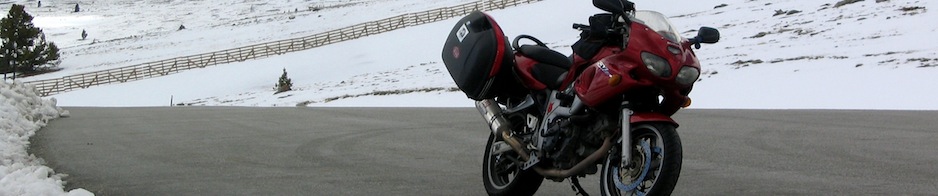
Proof that I rode to the summit.
I stopped for a couple of pictures on the way down Summit Rd. There aren’t a lot of flat places to stop for photos, but
I managed.

Looking north to the Sacramento Delta.

Looking south.
One of the neat things about Mt Diablo is that you can really see how the rock base changes depending on altitude.
Up at the top, the rocks are tan and dry; about halfway down, they become red and rusty. If I understand the geology
correctly, it’s silica-carbonate.

You can see the observation tower at the very top of the hill.
When Summit Road ended, I took South Gate Road back towards Danville. Overall, I think that I enjoyed South Gate Road
more than North Gate Road. It’s swoopy and beautiful, like North Gate. Eventually, it becomes narrow and twisty through
residential areas. I didn’t see any cops when I drove through, but signs proclaimed the area under radar surveillance,
and I believe it. It’s best to drive slowly through the area, anyway, due to kennels and horse farms and heavy pedestrian
traffic.
All too soon, I was back at Highway 680 and had to jump back on the East Bay freeways. I did manage one diversion: Niles
Canyon Road through Fremont, but the rest of the trip was all expressway.
All in all, it was a nice trip; hopefully the next time I head up to the summit will be after a rainfall. 🙂

The close-up GPS track log of the park. I have no idea why the routes didn’t always follow the road.

The entire route.