Santa Cruz Mountains: August 5, 2007
Exploration #1: Roaring Camp Railroads.
After a wonderful-as-always breakfast at Bobbi's Coffee Shop in Cupertino, I headed south on Highway 17 to the Summit Road exit. Turning left at the top of the exit (before the overpass), then heading straight, will take you to Mountain Charlie Road.
Five and a half miles long in this section, Mountain Charlie Road was named for Charles Henry McKiernan, an Irish settler in the Santa Cruz Mountains in the mid 1800s. To quote from one of my previous ride reports, "At the time, Mountain Charlie was best known for his fight with a grizzly bear. After happening upon the mother bear with cubs, he hit the mother with the butt of his rifle. Mama Bear didn't like this so much and bit out a large chunk of his head. Miraculously, Mountain Charlie survived, thanks in part to the addition of a metal plate made from Mexican coins surgically implanted into his skull."
In case metal skulls and grizzlies aren't enough to make you smile in your helmet, it's a great motorcycling road, too. Fortunately (because of the tight, twisty, narrow lanes), it's very lightly-trafficked and has beautiful views of the valley.
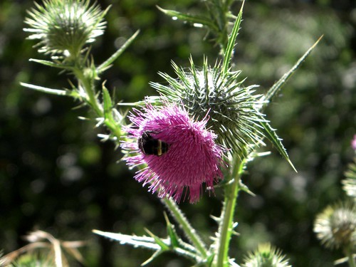
Thistles along Mountain Charlie Road:
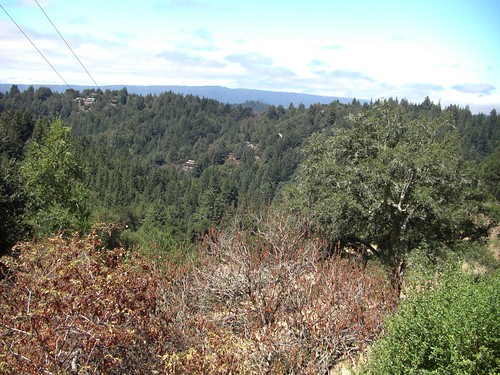
View from Mountain Charlie Road:
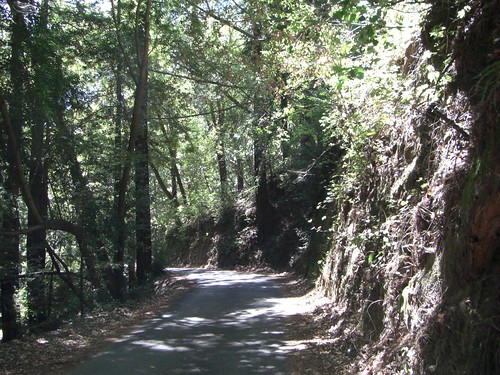
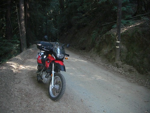
Typical section of Mountain Charlie Road:
At the intersection of Mountain Charlie Road and Glenwood Drive, I turned right onto the latter and enjoyed being able to wick it up a little bit on the well-paved wider sweepers. Only a mile later, though, I was back on the narrow and winding Bean Creek Road.
Bean Creek Road always makes me think of redwood trees, since there are so many of them lining Bean Creek (the actual creek, I mean, which parallels the road). There are quite a few areas to pull out and enjoy the trees and, on this particular Sunday, many families were doing so. Bean Creek itself was dry as a bone; I don't know if that's normal for August or due to our drought this year.
Redwoods along Bean Creek:
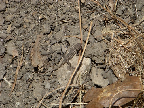
I stopped at one nice lookout along Bean Creek and almost stepped on a little lizard while climbing up onto the embankment. Oops, sorry little guy!
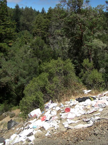
Unfortunately, the view from the embankment was diminished by a huge amount of trash thrown over the cliff. It was disgusting. Beer boxes, Coke cans, plastic trash bags...I don't know what kind of person can just jettison their garbage out into the wilderness. It made me angry and sad.
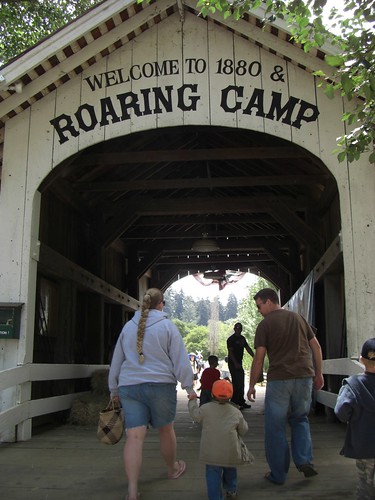
From Bean Creek Road, I took Mt Harmon Road through Scotts Valley until its terminus at Graham Hill Road. That intersection houses the Felton Covered Bridge County Park, which I really like, but my destination was just a little further down the road -- Roaring Camp Railroads.
I've ridden past Roaring Camp Railroads a few times but had never before stopped. I didn't even know what was there. Unfortunately, since it was a warm summer Sunday, what was there was people. Lots and lots and lots of people. I turned into the parking area before noticing that it was a pay lot and that there was a long line. Once I was in the line, there was no way to turn around so, cursing, I waited it out. I planned on telling the money-taker that I would just turn around and leave but, before I could say anything, he waved me in and said "go on ahead!".
Free motorcycle parking? I say OK! I figured that I could brave the crowds and look around since I didn't have to pay for parking, so I locked everything to the bike and wandered in over the covered bridge footpath.
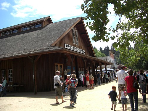
Everything inside was pretty kids-oriented (i.e. heavy "Thomas the Train" marketing). The lines for hot dogs etc were long as it was lunchtime, and the train rides themselves were all sold out until the afternoon. I enjoyed flipping through the railroad history books in the gift store but, in general, I think my next visit will have to wait until I'm with a kid who can go in the bouncy castle and run around eating rock candy and throwing things at the pond ducks.

Exploration #2: Railway trestle off of Hwy 9.
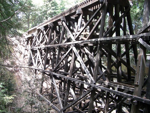
The next place I wanted to check out was also railroad-themed. Last week I had been on Highway 9 between Felton and Santa Cruz and had noticed a large railroad trestle alongside the road that looked like it had a dirt path behind it. I couldn't stop at the time and wanted to see what it was all about.
I found the trestle again easily and stopped for a photograph. While I was taking the pictures, a Jeep pulled up to drive up the dirt path. Since I was kinda directly in their way, they stopped while I moved my bike and I asked whether they lived up there. "No," the passenger said, "but we've been up a couple of times." I was encouraged that no mountain people shot at them (always a possibility on Santa Cruz Mountains dirt roads) and was thinking of trying the road myself...but then the Jeep reappeared mere moments later, reporting a fallen tree blocking the road just out of view. Doh! They joked that next time they'd be back with chainsaws.
Railroad trestle:
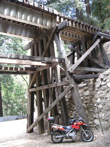
Dirt path heading off behind the trestle...someday I'll give it a shot!
Exploration #3: Alma Creek Road.
Now my interest was piqued to ride on some dirt. While reading Roads to Ride: South not long ago, I came across the following description of Aptos Creek Road:"Except for a short paved section near town, it's a narrow dirt and gravel road running alongside Aptos Creek in a dense forest of redwoods." OK! I wanted to check that out.
When Highway 9 met up with Highway 1, I hopped on the latter intending to cruise on down to Aptos. Unfortunately, eighteen thousand beachgoers also had the same idea and the highway was bumper-to-bumper. Sitting in traffic made me crave a milkshake and I asked my GPS to find me any nearby food. Foster's Freeze came up for the next exit, which sounded promising for a milkshake, so I took that exit and hit a couple of Santa Cruz surface streets to the restaurant. It was one of those wonderful shack-looking burger-and-ice cream stops. The cheeseburger was small and inoffensive and the chocolate milkshake was thick and gooey and yummy: the best ride food!

Thusly brain-freezed, I decided to skip Highway 1 and instead took Soquel Drive through Santa Cruz and Soquel and into Aptos. Lots of traffic lights but it was much lighter-trafficked than Highway 1 and there were some neat looking art stores and downtown shops.
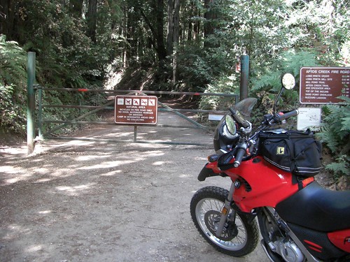
Aptos Creek Road starts just inside Aptos at the entrance to The Forest of Nisene Marks State Park. It's a very easy road to miss and I likely would have without the GPS; it's tucked in behind a strip mall with no signage.
World's happiest sign:

Nisene Marks was the mother of a Salinas farming family who donated about 9000 acres to the state upon her death in 1955. Today, the park is about 10,000 acres and contains lots of hiking and mountain biking trails as well as picnic areas.

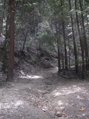
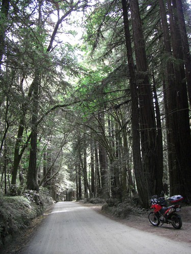
There were many people jogging, walking, and bicycling along Aptos Creek Fire Road, as it's known within park boundaries, so I kept my speed way down. Every time a car passed, huge plumes of dust would kick up for a full minute afterwards, so I tried to be aware of the people around me and would slow to a crawl whenever I passed anyone.
Just a wee bit dusty:
End of the road :(
I was frankly amazed that the road was still dirt. Most state park roads are either paved if motorized traffic is allowed, or gated off completely. It was a wonderful surprise to find this 3-mile long beautiful section of dirt road. There was a gate at the far end, past which only bicycles and hikers are allowed, but it was certainly no great hardship to turn around and ride the wonderful 3 miles back to the park entrance.
I thoroughly enjoyed this short-but-pretty dirt road and will certainly be back again.
Exploration #4: Laurel.
I've written before about my explorations around the Lexington Reservoir, near the old stage towns of Alma and Lexington (now drowned beneath the reservoir). I knew there was another one nearby, Laurel, so I decided to swing by there on my way home.
From Aptos, I retraced my steps on Soquel Drive back to, well, Soquel. I planned on heading north on Branciforte Drive, but apparently there are two such roads in Soquel and I wound up on the one that dead-ends six miles later at a golf course. Oops. I only really minded because some kind of bug hit me pretty hard under the left eye, which I thought was quite rude. Anyway, I backtracked until the GPS said, "oh, you wanted THAT Branciforte Drive!" and got me straightened out.
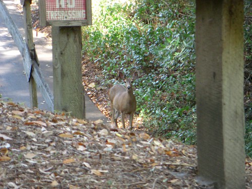
A few miles down the "real" Branciforte Drive, it comes to a Y-intersection with Vine Hill and Mountain View Roads. I pulled over for some Gatorade just after turning onto Mountain View Road and was almost immediately approached and inspected by a curious deer. I've seen deer each and every single time I've ever been on Mountain View Road, no matter what time of day.
I guess the deer can't read:
Mountain View Road leads to Soquel-San Jose Road (bet you can guess which cities that one connects), one of the nicest rides in the area. For some reason, it's never really heavily trafficked and it has great sweepers and fun corners. No pictures of this road as I was having too much fun riding.
Almost to Summit Road, I turned left onto Redwood Lodge Road. About this time, my bike started acting funny. It started surging and stalling...the dreaded F650GS curse! Dammit. I rode very slowly and cautiously as it's tricky to navigate narrow rough twisties with a bucking bike.
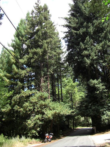
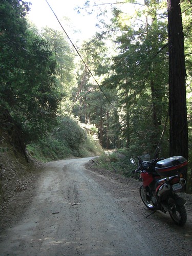
Redwood Lodge Road:

I turned right onto Schulties Road, where my book said the old buildings of Laurel are. I never did see anything other than one new-looking house right at the intersection, though; maybe they've been torn down since the book was published?
What I did find, however, was an unexpected fun dirt road! I suppose Schulties is officially paved, as some segments of road could charitably be called "rough concrete" and there was a "loose gravel" CalTrans sign at the beginning of the road. It was way fun on the dualsport, though, and would have been even more so had my bike not been sputtering and surging and being a right pain in the ass.
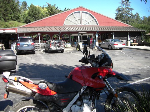
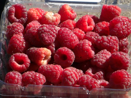
Once at the top of the hill, I rode 2 miles out of my way to the Summit Store. I was hoping the bike would fix itself if parked in the shade for a few minutes, but no dice. I did enjoy a nice pint of local raspberries, though.
Yum!
And that was pretty much my ride. I took Highway 17 directly home, which was invigorating due to heavy traffic and a bucking bike. A succcessful day of exploration!
Trip stats:
Trip odometer: 111 miles
Max speed: 80 mph
Moving average: 24.9 mph
Moving time: 4 hours, 27 minutes
