email me
February 19, 2007
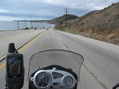
We took I-5 north from San Diego to San Clemente; 60 miles on roads clearly not built with rain in mind. The righthand lanes were mostly OK, but cars in the lefthand lanes seemed frequently surprised to come across deep puddles at 80mph.
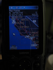
At San Clemente we veered off on Hwy 1 towards "the Beach cities". Laguna Beach. Newport Beach. Huntington Beach. Long Beach. Redondo Beach. Growing up in the Midwest, these names conjured up images for me of sun, sand, and ageless beautiful people. On a grey misty day in February, though, they looked awfully similar to Half Moon Bay or Pescadero...or, well, what our Northern California coastal towns would look like with ten times the art galleries and high end jewelry stores.
At Long Beach, we ignorantly stayed on Hwy 1 through Los Angeles towards Redondo Beach and up towards Santa Monica (as opposed to hopping on interstates long enough to get through LA). It took us two hours to go 50 miles of red light after red light after strip mall after red light through the 850 trillion municipalities that make up Los Angeles.
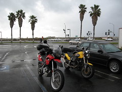
Approximately half our lives later, we stopped for lunch at a gas station Taco Bell in Malibu (living the high life, you see), where fortunately both the weather and the congestion was improving. A friendly trucker saw us looking at maps and wandered over to ask about our trip. He recommended taking Hwy 154 from Santa Barbara to Solvang -- a route I'd partially done with Stephanie in early 2006 -- to shave off some time and see some new scenery. I didn't particularly care about shaving off 25 minutes, but any scenery that didn't include "Fashion Park" was sounding pretty good to me.
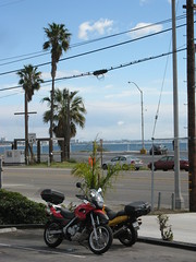
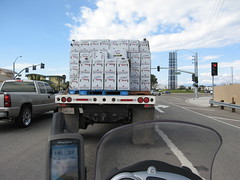
Continuing on Highway 1 through Oxnard was a radical departure from the coastal wealth of the beach cities. This is a farming town (Oxnard has the dubious honor of being the world's lima bean capital) with military bases and the busiest commerical port between LA and San Francisco.
Apparently, if lima beans aren't your thing, you can also get celery in Oxnard:
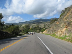
In Santa Barbara, we took the advice of our Malibu trucker friend and headed northwest on Hwy 154 towards Solvang. It's a gorgeous 25-mile stretch over the Santa Ynez Mountains, a young coastal range almost entirely within the Los Padres National Forest. The scenery did, indeed, improve my mood dramatically. I love this area surrounding Solvang. I've only ever been there in winter, so if that area is ever not neon green and lush, I don't want to know about it.
We hopped on northbound Highway 101 at Solvang and, frankly, there isn't much more of the trip to report after that. 260 miles of Hwy 101, going through San Luis Obispo and Paso Robles and King City and Gilroy and finally home. It got dark and cold around Paso Robles, shortening both our breaks and the time in between them.
All in all, a wonderful trip. I'm already looking forward to my next Mexican adventure.
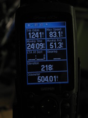
Stats:
Monday: 504 miles
Total: 1241 miles