Well, all good things must come to an end and, sadly, this trip is no exception. Â I woke up bright and early this morning, right at my usual time. Â I was OK with that, though, because it allowed me to eat a bigger meal at IHOP and still be on the road by 9am.
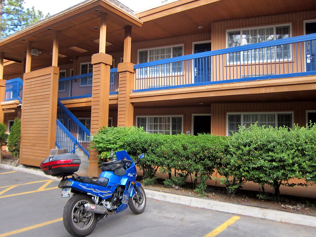
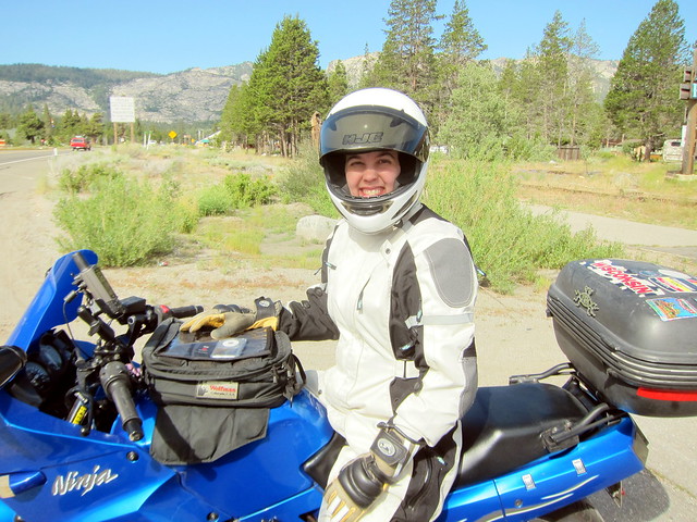
By the way, I had a really excellent stay at the Holiday Inn Express in South Lake Tahoe. Â Even the coffee in the lobby was tasty…plus, they were considerate enough to decorate to match the Ninjette.
Not terribly surprisingly, my GPS wouldn’t start up again this morning. Â Even my “swap the batteries” trick didn’t work. Â I was headed the same direction as yesterday for the first 40 miles or so, though, so I pulled on my big girl helmet* Â and was only marginally uncomfortable instead of in a panic. Â I decided to leave the GPS off and think threatening thoughts at it and try it again in Markleeville.
* This is a lie. Â My helmet is a children’s size small.
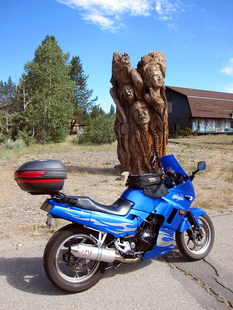
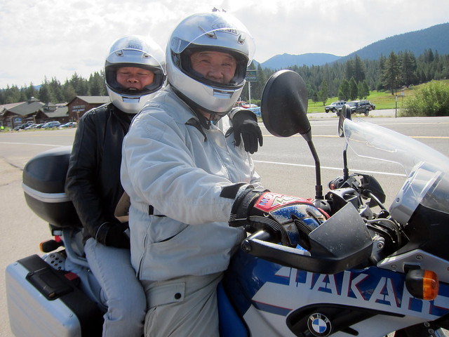
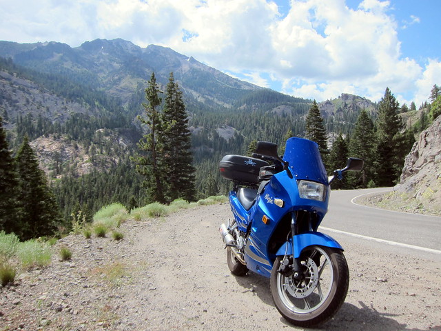
My first stop was in Meyers, to photograph the creepy Native American roadside statue for the Equinox to Equinox Rally (7 points!). Â As I was pulling out, who should see me and stop but the F650GS Dakar couple! Â We laughed and waved and I finally took a photo of them and they returned the favor.
In Meyers, I had a small routing decision. Â I could be responsible and take Highway 50 directly home, or I could have more fun and take the longer, windy Highway 4. Â I contemplated this decision for about 5 seconds.
It felt really good to make that decision, by the way. Â One of the things Alison and I had discussed at dinner last night was how men and women sacrifice differently for their kids (yes, sweeping generalization. Deal.). Â As moms, both of us tend to rush home or run straight inside if we’ve been out sans children, whereas the men seem to take their time and maybe stop at the store on their way home or do something outside or in the garage after arriving at home. Â So it felt odd to me to intentionally decide to take the long way home and not rush back immediately. Â It felt very decadent. 😉
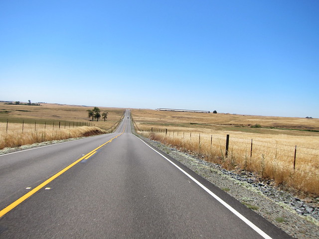
Anyway, back south to Markleeville I went. Â I didn’t take many photos along the route this time; surprisingly enough, the scenery looked the same as it did yesterday. Â Periodically, I tried hitting the power button on the GPS but it stubbornly stayed off.
In Markleeville, I stopped to photograph a historical marker that I didn’t see yesterday (5 points!). Â Guess who pulled up while I was stopped? Â At this point, we decided fate had brought us together and we all finally exchanged names and email addresses. Â Dennis and Zenny live up near Sonoma, so who knows, maybe we’ll bump into each other on the local roads someday. 😉
We headed south on Hwy 89 together until the junction with Hwy 4; at that point, I was heading west on 4 and they were going back over Monitor Pass to Hwy 395 to visit Bodie.
Incidentally, the GPS started working at this point again, too. Â Ugh, that damn thing. Â I’m going to teach it a lesson and totally buy a new one. Â You hear that, inanimate object??
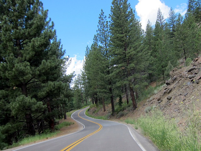
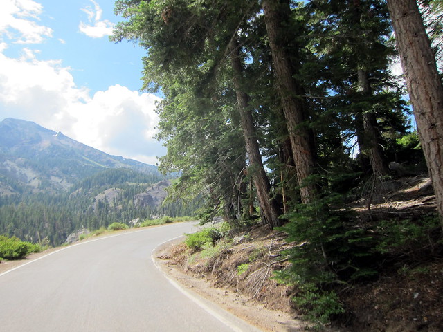
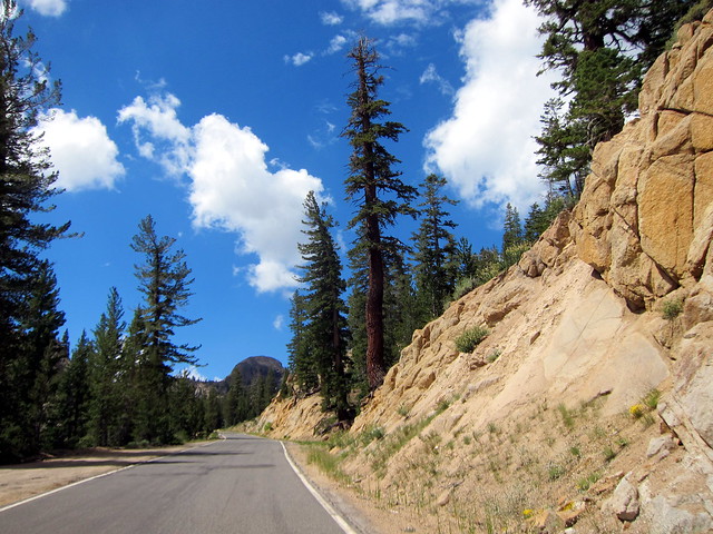
Highway 4 runs over Ebbetts Pass and is Northern California’s highest road. Â This paragraph from Wikipedia explains why it’s such a great motorcycling road:
“Today, Ebbetts Pass is one of the least traveled passes in the Sierra Nevada. An extensive section of highway over the pass is less than two lanes with no dividing line. It has very steep sections with hairpin corners.  The eastern slope is particularly difficult, as many of the hairpin corners are blind, and steepen suddenly at the apex, making it necessary to shift to first gear in most vehicles. It is rarely used by commercial traffic and is not recommended for vehicles towing long trailers.”
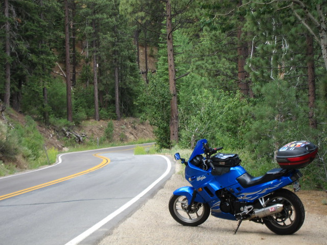
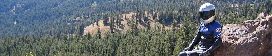
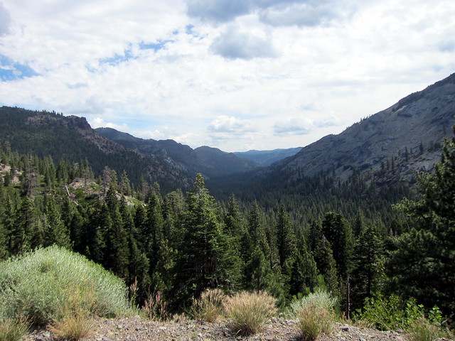
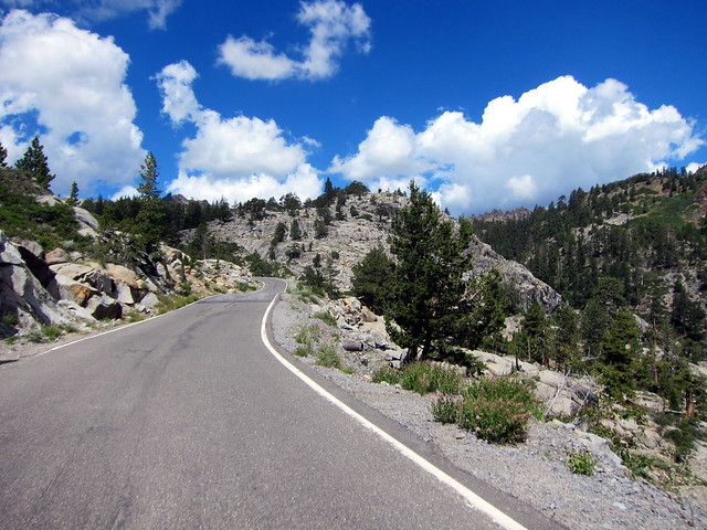
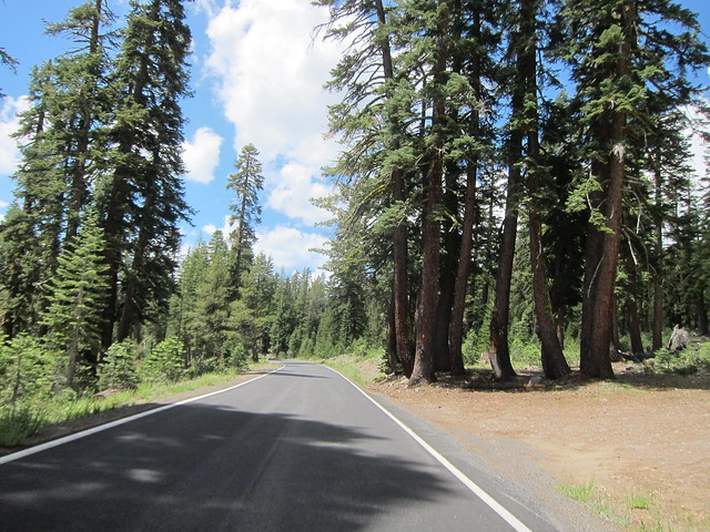
I stopped for a while at an apex with a particularly amazing view. Â I tried to capture it with the camera — the sheer vastness of the canyon, the trees, the vista — but nothing I did came close. Â I finally just set the camera down and just sat for a while, looking.
Anything I write about Highway 4 is filler; trite. Â It is 50-odd miles of one lane twisties, trees, rocks, sky. Â It’s a riding road; a thinking road. Â Eventually I even stopped taking pictures and just entered a zen-like trance. Â That also might have been because I was getting hungry and there was no food until Arnold. Â But I like to think it was because of the road.
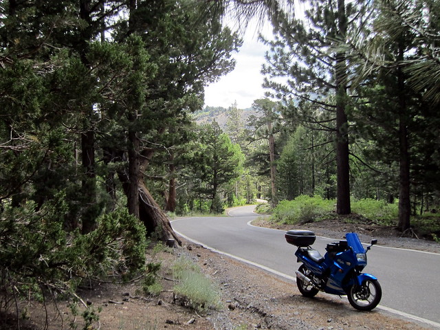

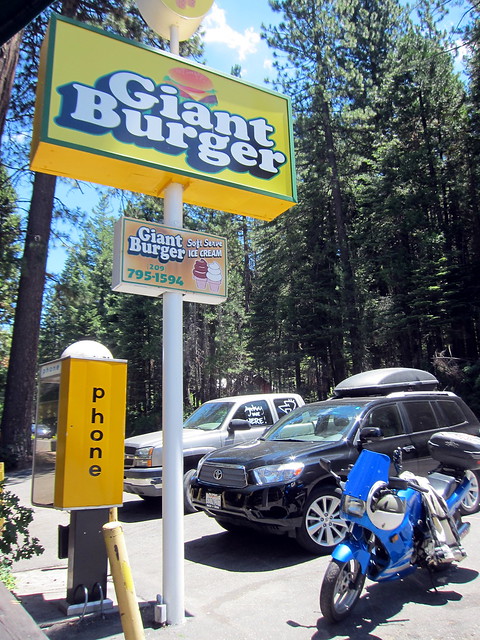
By the time I pulled into Arnold, I was pretty hungry. Â I stopped at the first restaurant I saw: Giant Burger. Â OK! Â A giant burger sounds good! Â In fact, I ordered their “baby burger” so that I would also have room for fries and a chocolate milkshake. Â Nom nom nom.
The couple at the table next to me was from Berkeley and had a very cute 2-year-old son. We chatted about computers and kids. Â Good times.
As I geared up to leave the restaurant, I noticed it had gotten warmer. Â I had actually been wearing a thin long sleeved shirt until Arnold, but when I left I removed it and started opening the vents on the Teiz suit. Â I knew I’d be hitting the hot central valley soon, but I didn’t realize the weather extended as far east as Arnold. Â Sigh…elevation, I missed you already.
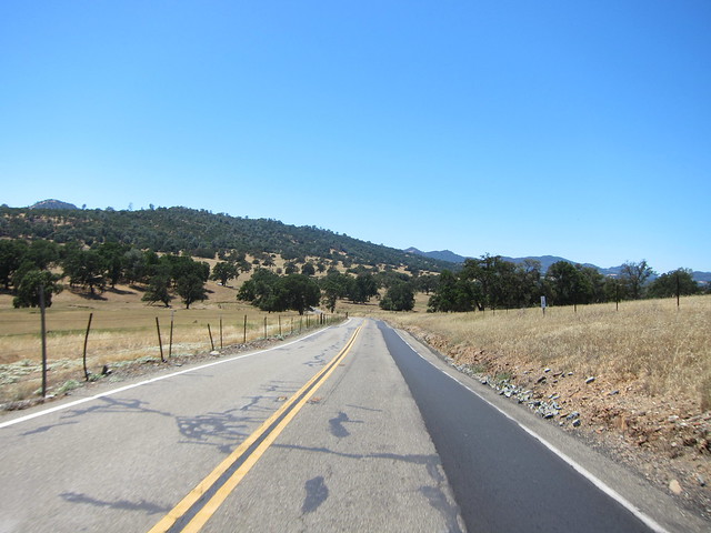
I stopped for a few Equinox to Equinox historical marker photos in Murphys but then decided to call it quits on stopping. Â It was just too darn hot to stop, take a photo, send the email, put the placard away, get going again, lather, rinse, repeat. Â By the time I stopped for water and gas in Copperopolis, it was in the mid to high 90s with no respite for at least 50 more miles. Â Ugh, central valley.
At least this far east, the scenery is nice so that you have something to look at while you immolate.
Past Copperopolis, though, you don’t even have that. Â You’re just hot and it sucks. Â Peg the throttle and get through quickly. Bleccccch.
A shout-out to my Midwestern homies:
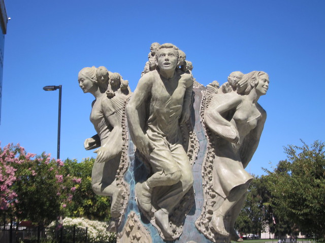
I stopped in Stockton for some Equinox to Equinox photos and came across this horrifying statue of people with little screaming heads growing out of their heads. Â No Google results have answered my question of what in the holy hell this is all about. Â Anyone know?
I took the interstate between Stockton and Livermore because there really isn’t anything else to do. Â I remembered along the way how much I hate the interstate between Stockton and Livermore. Â It crosses Altamont Pass, home to a large wind farm, so it’s insanely windy (fun on a 250cc bike) and is chock full of drafting semis.
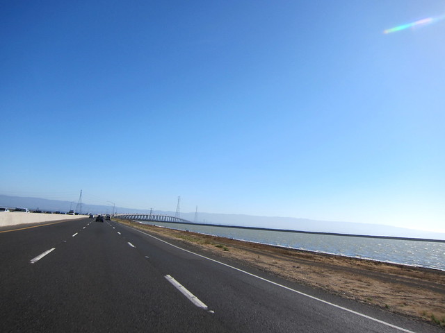
I got off the interstate in Livermore and took back roads through the East Bay to the Dumbarton Bridge…
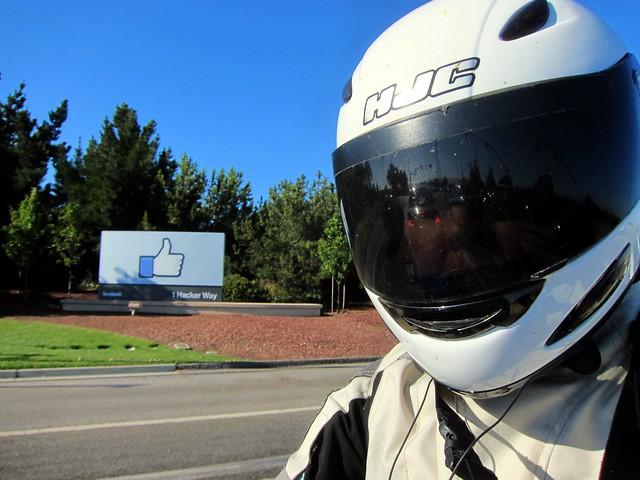
….past a small local company that you may have heard of…..
…and home again, home again, bippity bop!

(The actual mileage for the day — and the total, too — is 33 miles more than recorded above since the GPS didn’t start working until Markleeville. Â So, 256 miles today and 714 miles total.)
All together, it was a wonderful trip. Â Great roads, gorgeous scenery, I met some neat people, I had a fun dinner with a good friend, I had some adversity that I got to overcome with grace and humility 😉 and I did manage to sleep in a tiny bit. Â I call that a success!
3 Responses to South Lake Tahoe: Day 4