I got a text message this morning from a relative in Wisconsin, saying in part, “It just started snowing.” Â I mention this because it was 80F and sunny here today. Â Now, to balance things out, our monthly mortgage payment in the Bay Area is more than the TOTAL amount of rent I paid my senior year of college, but did I mention 80F? Â And sunny?
OK, honestly, this is unseasonable weather here too. Â Normally it’s gray and rainy and is supposed to be so later this week. Â So I took advantage of August-in-November and went on a long ride today.
After a nice breakfast at The Depot Cafe, I hopped on I-280 and headed north.

I haven’t been over the Golden Gate in years! Â It was pretty much as I remembered it. 😉
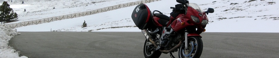
I made a quick stop at the Marin Headlands for bike pr0n photos. Â It was the wrong time of day for it — shooting into the sun — but I knew I’d be cutting my return trip awfully close to the witching hour when traffic turns into an utter nightmare and I didn’t want to chance stopping then.

I hopped back on Highway 101 north to Highway 1 and headed towards Mt Tamalpais/Muir Woods. My ultimate destination was the summit of Mt Tam; I’ve only ever been up there once before, in July 2007.  I honestly don’t know why I never think of Mt Tam as a good ride destination but, I’ll tell you, I will after today’s ride.  This was honest to goodness the best day riding I’ve had in a really long time.

Once inside the State Park boundaries, I headed up Panoramic Highway (I mean, really; can you go wrong with a name like that?) towards East Peak. Â I pulled over at a turnout to admire the view:

The city skyline is San Francisco; you can also see Sutro Tower allllll the way over to the righthand side of the photo.
The rest of the ride up to the East Peak parking/rest area (2571′) was crazy awesome. Â I had remembered gravel in the corners from my previous ride but there wasn’t any today. Â There also wasn’t any traffic; I seriously recommend Tuesdays for your Bay Area motorcycle rides.

The seasonal gift shop/snack bar was closed (as far as I can tell, it’s open daily during the summer, otherwise only on weekends) but there’s a soda machine and restrooms open whenever. Â There was also surprisingly good cell service and the park’s website boasts that the park has free WiFi if you’re near a ranger station. Â Cool!
From the same website:
“On a clear day, visitors can see the Farallon Islands 25 miles out to sea, the Marin County hills, San Francisco and the bay, hills and cities of the East Bay, and Mount Diablo. On rare occasions, the Sierra Nevada’s snow-covered mountains can be seen 150 miles away.”
Well, as you can see, I wasn’t there on a particularly clear day, but the view was still neat. Heck, even when the view is totally fogged in (like it was in 2007), it’s still really cool to be above the fog, looking down.
San Francisco and Richardson Bay:

November what now?

I took Ridgecrest Blvd back down from East Peak (it’s a one-way-in, one-way-out kind of situation) and then headed east onto Bolinas-Fairfax Road which connects the towns of…you guessed it! Bolinas and Fairfax.
These roads were so good and the weather was so nice that I just kept saying “oh, come on now” in my helmet. Â I got sick of taking pictures of the roads and scenery. 😉


See, now I’m just being mean. Â Did I mention 80F?

Hello!

After a while of oak woodlands, the road enters a redwood grove. Â I had my usual troubles of photographing the road in the redwoods, so I finally just pulled over and used my mini tripod.

Proof I do have a head underneath the helmet:

After the redwoods, Bolias-Fairfax Road twists alongside Alpine Lake (actually a reservoir) for a while.
I mean, really. Â What in the heck was with this weather and scenery? Â I can’t even make this stuff up.

Literally everyone I saw on the road today was smiling and waving. Â Motorcyclists, bicyclists, even pickup truck drivers.
I stopped in Fairfax for a late lunch at M&G Burgers. Â It was thoroughly adequate food, but it was quick, which was my primary criterion.

From Fairfax, I hopped back onto Highway 101 south and hightailed it back over the Golden Gate and through San Francisco. Â I had absolutely no intention of being caught in the cesspool of traffic that happens in the evening, so I was super happy to be crossing the bridge right around 2:30pm.

And back down 19th Street.

I wound up riding down 19th ahead of a guy on a BMW R1150GS and we chatted at the red lights. Â Over the 3-mile trek through the city, I learned that he liked the Beemer though it was a bit big for the city, and that he’d once ridden a Honda Magma to Cabo, but decided to sell it there and fly home. Â He also had a college buddy that’d had a Ninja 250 and was hoping to take the Beemer through the Yukon at some point. Â As you can tell, there are a lot of red lights along 19th Street.
My 19th St buddy after we’d both gotten onto I-280 south:

And that was pretty much that; a straight hop down 280 and home. Â Yay! Â Not the longest ride I’ve done lately, but definitely the most fun. Â I can’t honestly remember the last time I had so much fun on a ride. Â OK, rain, you can come now; that was a good final ride of the season (though, y’know, if you want to stay away on Tuesdays in the future, that’d be OK with me too).

6 Responses to Ride to Mt. Tamalpais