December? What’s that? Yesterday morning was sunny and 55F. I consulted my trusty Day Trips: Roaming the Backroads of Northern California and decided to do the “Zayante and Mt. Charlie Roads” loop.
Mountain Charlie Road crosses Highway 17 right at Summit Road. The loop in the book wanted me to go west on Mountain Charlie, but I knew there was a historical marker to the east that I hadn’t yet captured, so I headed east for a mile or so first.
Heading east on Mountain Charlie Road takes you down the hill towards Old Santa Cruz Highway along a narrow and twisty road. It’s very lightly trafficked, unless you happen to be riding in early December — there are quite a few Christmas tree farms in the area. Valley residents in big SUVs who don’t normally drive in the mountains and who are distracted by looking for a tree farm entrance are a big risk this time of year, so I drove slowly and hugged the righthand side of the road.
The intersection of Mountain Charlie and Old Santa Cruz marks Patchen, the most accessible of the five Santa Cruz Mountains “ghost towns”. Alma and Lexington are now buried under the Lexington Reservoir; Laurel is just east of Hwy 17 (I’ve never been but intend to one of these days). I don’t know offhand where Wright’s Station is.
Anyway, all that remains of Patchen, CA today is the Christmas tree farm…but what a farm! I didn’t go in (too many SUVs and overly hyperactive children) but it’s a pretty cool place where you can choose and cut your own tree — Monterey Pine, Douglas Fir, or Sierra Redwood — at a pretty reasonable price.

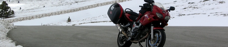
This old jalopy is next to the historical marker…hrm, which one to ride home?

After photographing the Patchen historical marker, I retraced my route back up Mountain Charlie Road to Hwy 17. A brief stint on Summit Road reconnected me with Mountain Charlie Road on the other side of the highway.
OK, time to talk about Mountain Charlie himself. Charles Henry McKiernan was an Irish settler in the Santa Cruz Mountains in the mid 1800s. Now, Mountain Charlie is most well known for being one of the first settlers of the area, and for forging the road that now bears his name (it was originally called the McKiernan Toll Road).
At the time, however, Mountain Charlie was best known for his fight with a grizzly bear. After happening upon the mother bear with cubs, he hit the mother with the butt of his rifle. Mama Bear didn’t like this so much and bit out a large chunk of his head. Miraculously, Mountain Charlie survived, thanks in part to the addition of a metal plate made from Mexican coins surgically implanted into his skull.
A short ways up the road is Mountain Charlie’s cabin with both a historical marker and — you guessed it — a Christmas tree farm.

I didn’t take any photos along Mountain Charlie Road itself because it’s very narrow with few places to turn out. I went slowly — sometimes down to 10mph — due to the very blind curves with sheer rock faces on one side and mountain cliffs on the other. The views were beautiful, though, when the scenery opened up over the various valleys in the Santa Cruz Mountains.
Mountain Charlie Road eventually ends at Glenwood Dr; I turned right and then right again onto Bean Creek Road. I enjoyed Bean Creek very much. Slightly wider than Mountain Charlie Road, it has low enough elevation to show off some of the area’s redwoods.

Bean Creek brought me into Scotts Valley, where I turned right on Mt Harmon Road to go to Felton. I stopped by the Covered Bridge which, somehow, I had never managed to visit before. The bridge was Felton’s only route to Santa Cruz until the 1930s, when a paved road was built and the bridge became pedestrian-only. It’s made from local redwood and is said to be the tallest covered bridge in the country.


From Felton, I turned back north on East Zayante Road. More deep wooded twisty riding, this time alongside a small stream. Smattered about the hillsides were obvious waterfall markings; if we’d have gotten our normal November and December precipitation, Zayante would have mud and rocks strewn about and the creek would be much higher.
I stopped for a soda and Clif bar at the Zayante Market and Deli. While meandering about eating my snack, I noticed the burnt out shell of a building across the street. By chance, I then happened to see the community newspaper at the market with its headline “Club Zayante Burns: From family swimming club to concert hall to nudist retreat, landmark is now leveled.”
Duly convinced that the burnt building was not someone’s private home, I walked across the street to investigate. The accident, likely caused by a wood burning stove, was over a month ago (Oct 26) but the faint smell of burning wood still hung in the air like a campfire. Club Zayante was opened in 1969 by Tom Louagie. The building had originally been built in the 20’s as a storage shed for road building equipment, but had been converted into a country club. Until its closure in 1983, “Club Z” was a refuge for eclectic singers and musical acts. Anything went that stuck Louagie’s fancy, and rumor has it that even John Lee Hooker played there. The swimming pool slowly and surely was used for skinny dipping after a sauna was built.
Tom Louagie still lived at Club Zayante, along with renters, who were home when the Oct 26 fire broke out. The tenants escaped by jumping out the windows, but Louagie was found wandering along the road, covered with second and third degree burns. Assumedly, he has survived, but all that remains of this piece of Santa Cruz Mountains history is that faint smell of campfire.


Zayante Road returns to Summit Road, off of Highway 17. Not quite wanting to go home yet, I quickly exited Hwy 17 onto Alma Bridge Road to circumnavigate the Lexington Reservoir. The names of these places of course refer to the towns that the reservoir now drowns — Alma and Lexington. Two stops on the stagecoach trail that ran from Mountain Charlie’s to Patchen and on to Los Gatos and San Jose, the towns were part of a noted “mile of saloons”. In the late 1800s, Alma in particular was a flourishing community with a post office, train station, school, etc. Unfortunately, the Southern Pacific Railway ceased using Alma as a stop in 1905, and when the shiny new highway to Santa Cruz (completed in 1940) bypassed the town…well, you know the rest.
The Lexington Reservoir was completed in 1952. When the water level is particularly low due to drought, you can sometimes see the Santa Cruz Highway and Alma Bridge — all that’s left of these two historic towns.

Ride stats:
Trip odometer: 74 miles
Moving Time: 2 hours, 40 minutes
Average Moving Speed: 27.7mph
5 Responses to Western Santa Cruz Mountains ride